Asset Store
Discover high-quality assets for your next game project, or create your own with AI.
Create AssetDiscover high-quality assets for your next game project, or create your own with AI.
Create Asset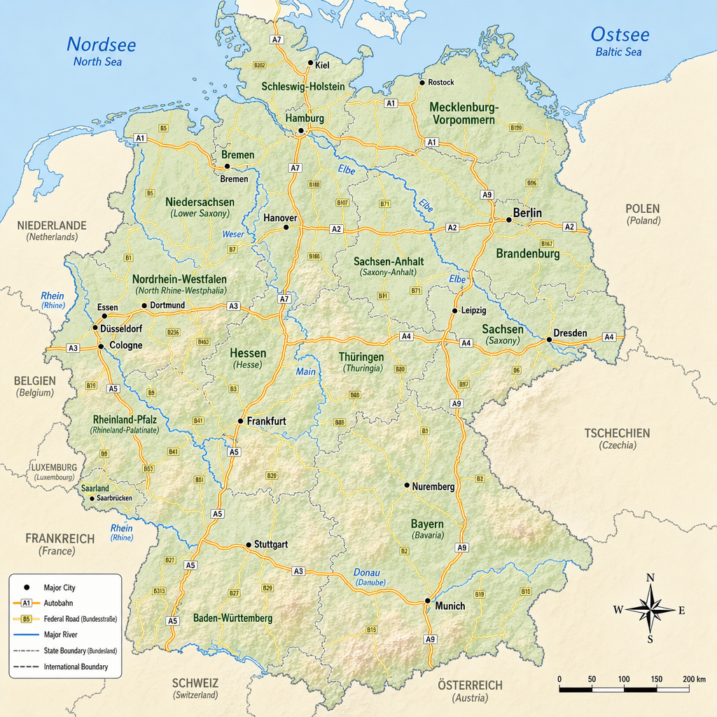
Made with GPT Image 2 · CC0 · 19 Jun 2026
Generated from: A large, detailed top-down map of Germany showing the entire country with all 16 federal states (Bundeslaender) clearly outlined with thin borders. The map should have a realistic cartographic style with subtle topographic shading. Major cities (Berlin, Hamburg, Munich, Cologne, Frankfurt, Stuttgart, Duesseldorf, Leipzig, Dortmund, Essen, Bremen, Dresden, Hanover, Nuremberg) marked with small dots and clear readable labels in black text. Major autobahns (A1, A2, A3, A4, A5, A7, A9) drawn as thick orange-yellow lines with small white "A1" "A2" etc labels directly on the road lines. Important Bundesstrassen shown as thinner yellow lines. Major rivers (Rhine/Rhein, Elbe, Danube/Donau, Main, Weser) visible as blue lines with river names in blue italic text. Cities should have their names readable in a clean sans-serif font. The background should be a light beige/cream color, land in light green-gray, water bodies (North Sea/Nordsee, Baltic Sea/Ostsee) in light blue with sea labels. Clean vector-style rendering, top-down view, square 1:1 proportions with Germany centered. High resolution, readable text labels throughout.
Creator
user_cad0b1f6
Sign in to join the conversation.
Sign in to comment🌍CC0
Use, share, and remix the model freely with no restrictions and no attribution needed.