Asset Store
Discover high-quality assets for your next game project, or create your own with AI.
Create AssetDiscover high-quality assets for your next game project, or create your own with AI.
Create Asset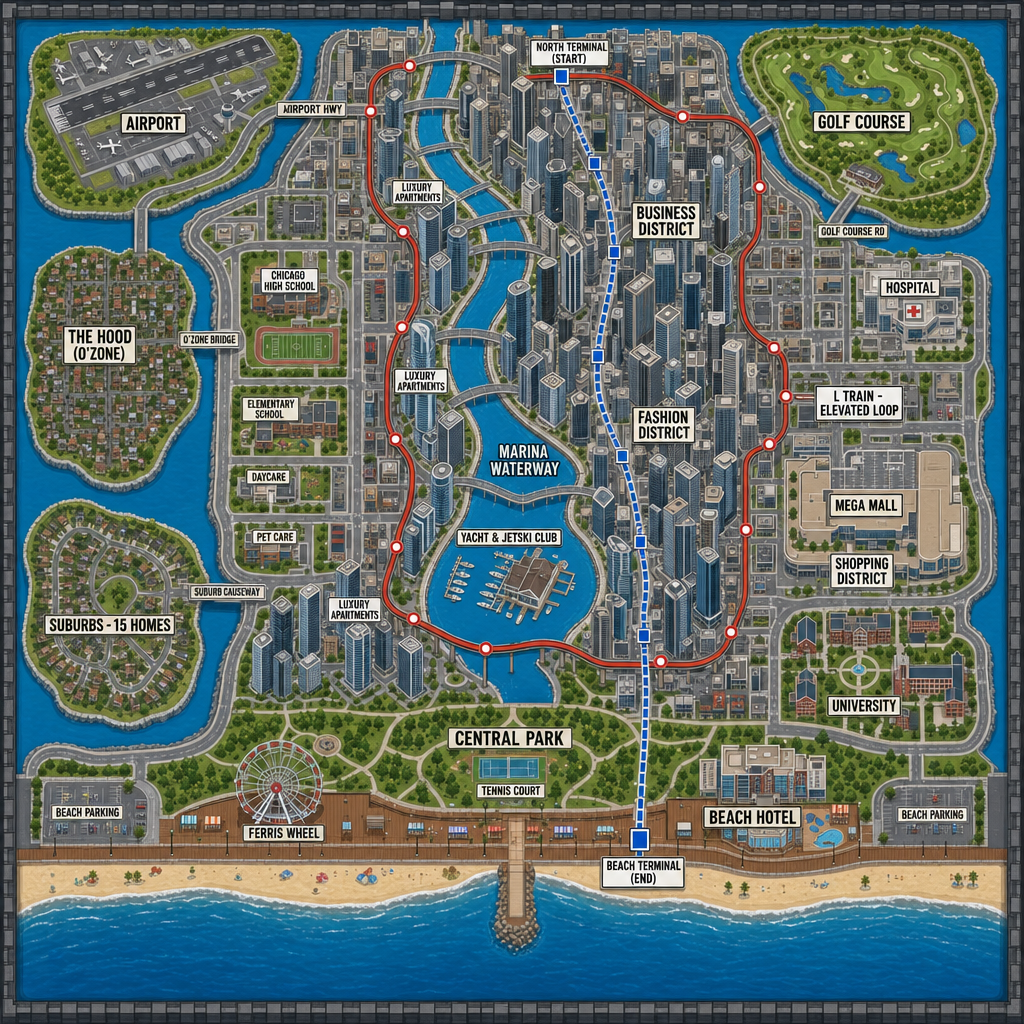
Made with GPT Image 2 · CC0 · 19 Jul 2026
Generated from: Flat orthographic top-down 2D city map for a roleplay game, perfectly straight overhead view, zero tilt, no perspective, square layout. BOUNDED by thick dark gray boundary walls on all four edges; nothing continues past them. HERO FEATURE - a DUBAI MARINA style waterway: a wide, long, curving blue canal river that enters from the ocean at the bottom edge and winds in sweeping S-curves ALL THE WAY THROUGH the city from south to north, passing between dense clusters of tall skyscrapers that line BOTH of its banks like Dubai Marina. The waterway visibly connects to the open ocean at the bottom. It is crossed by many small bridges. Label it "MARINA WATERWAY". On a wide bend of the waterway downtown, place a marina basin with small docked boat slips labeled "YACHT & JETSKI CLUB" with a small club building and dock fingers. MAIN CITY (center-east): very dense downtown with MANY tall skyscraper blocks packed tightly together forming street canyons along the waterway, Dubai/Chicago style, varying tower heights. Labeled districts: "BUSINESS DISTRICT", "HOSPITAL", "FASHION DISTRICT", "MEGA MALL" (one huge building) inside "SHOPPING DISTRICT", "UNIVERSITY" campus, and three towers each labeled "LUXURY APARTMENTS" placed along the waterway in different spots. Many small unlabeled shop/restaurant blocks along avenues. The map is split into SEPARATE ISLANDS / LOCATIONS connected only by labeled roads and bridges, each surrounded by green buffer or water so each feels secluded and reached by a drive: - ISLAND WEST: dense small-house blocks labeled "THE HOOD (O'ZONE)", one bridge road to the city. - ISLAND SOUTHWEST: curved-street suburb labeled "SUBURBS - 15 HOMES", one causeway. - ISLAND NORTHWEST: airport runway strip labeled "AIRPORT", one highway. - ISLAND NORTHEAST: green golf course labeled "GOLF COURSE", one road. BOTTOM EDGE (south): blue ocean with a MODERATE narrower sandy beach strip (not oversized) facing the bottom, brown boardwalk and sidewalk behind it, two small lots labeled "BEACH PARKING". On the boardwalk: "FERRIS WHEEL" and "BEACH HOTEL". Just north: "CENTRAL PARK" with "TENNIS COURT". Schools/services on the west near Island 2: "CHICAGO HIGH SCHOOL" with sports field, "ELEMENTARY SCHOOL", "DAYCARE", "PET CARE". METRO lines with stations and terminals: a solid red ELEVATED line on pillars looping through the downtown skyscraper blocks labeled "L TRAIN - ELEVATED LOOP" with red station dots; a dashed blue UNDERGROUND line from "NORTH TERMINAL (START)" through downtown to "BEACH TERMINAL (END)" with blue station squares. Roads: clear light-gray roads with strong contrast, street grid plus diagonals inside the city, many bridges over the waterway, and connecting causeway roads between islands. Style: clean flat vector game-map style, muted colors, crisp bold black ALL CAPS text labels exactly as written, no 3D buildings, no shadows, no gradients, no compass, no extra decorative text.
Creator
Yanan Xie
Sign in to join the conversation.
Sign in to comment🌍CC0
Use, share, and remix the model freely with no restrictions and no attribution needed.