Asset Store
Discover high-quality assets for your next game project, or create your own with AI.
Create AssetDiscover high-quality assets for your next game project, or create your own with AI.
Create Asset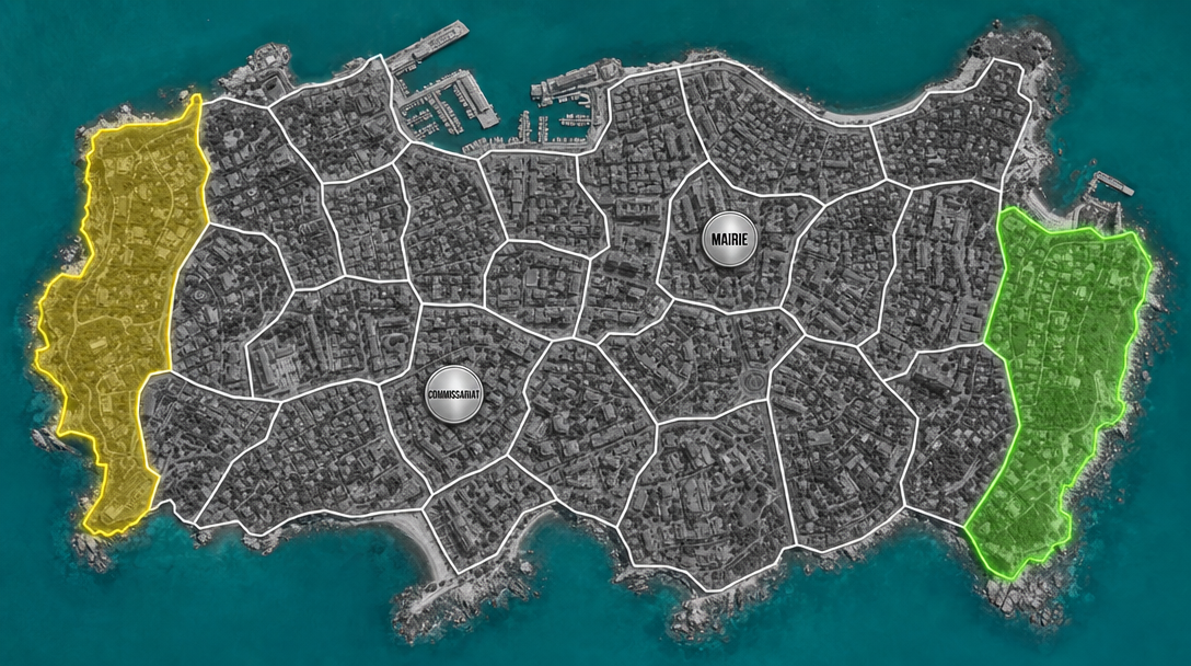
Made with GPT Image 2 · CC0 · 6 Jul 2026
Generated from: A top-down satellite map of a coastal city for a 2-player strategy game. The entire landmass is partitioned into exactly 20 irregular polygonal zones separated by thin white borders -- every piece of land belongs to exactly one zone, no land is left unzoned. Only water areas (teal/cyan) are outside zones. The base layer is a grayscale satellite photo of a real city with buildings and roads. The 20 zones form a complete land tessellation with no gaps. EXACTLY TWO zones have colored overlays: one zone on the far left edge has a semi-transparent yellow fill with a glowing yellow border. One zone on the far right edge has a semi-transparent green fill with a glowing green border. These are the only colored zones. The other 18 zones are neutral -- only white borders, no color fill. EXACTLY ONE silver circular badge that says "MAIRIE" in bold black text, placed in ONE neutral zone. EXACTLY ONE silver circular badge that says "COMMISSARIAT" in bold black text, placed in ONE DIFFERENT neutral zone. There must be only ONE of each badge on the entire map. No other text anywhere.
Creator
user_f87579b0
Sign in to join the conversation.
Sign in to comment🌍CC0
Use, share, and remix the model freely with no restrictions and no attribution needed.