Asset Store
Discover high-quality assets for your next game project, or create your own with AI.
Create AssetDiscover high-quality assets for your next game project, or create your own with AI.
Create Asset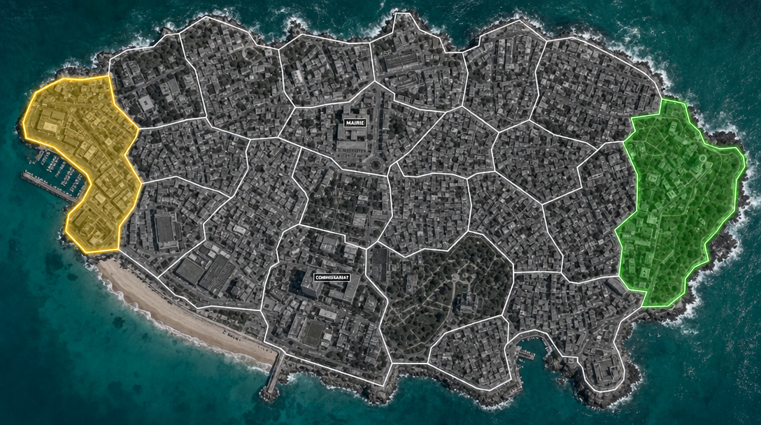
Made with GPT Image 2 · CC0 · 6 Jul 2026
Generated from: A top-down satellite map of a coastal city for a 2-player strategy game. The entire landmass is partitioned into 20 irregular polygonal zones with thin white borders forming a complete tessellation -- zones cover all land including coastal edges, extending slightly into water at the shoreline so no land is left unzoned. No zone consists only of water. The base is a grayscale satellite photo of a real city with buildings and roads. Water is teal/cyan. Only TWO zones have colored overlays: one zone on the far left with semi-transparent yellow fill and glowing yellow border. One zone on the far right with semi-transparent green fill and glowing green border. The other 18 zones are neutral with only white borders. Mark exactly TWO specific buildings directly on the map: ONE building has the word "MAIRIE" written on it in a small rectangular label. ONE DIFFERENT building in a different neutral zone has the word "COMMISSARIAT" written on it in a small rectangular label. These are labels placed directly on buildings -- no circular badges, no floating icons. Just small text labels on actual buildings.
Creator
user_f87579b0
Sign in to join the conversation.
Sign in to comment🌍CC0
Use, share, and remix the model freely with no restrictions and no attribution needed.